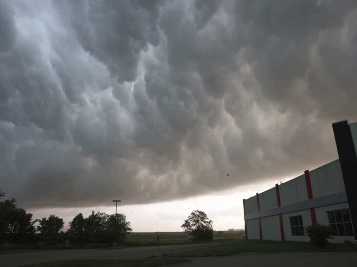
As of today, April 30, 2025, the Dallas weather has turned dangerously active with a Tornado Watch in effect until 5:00 PM. Thunderstorms are intensifying across North Texas, and meteorologists are warning of damaging winds, large hail, and isolated tornadoes. Several counties are already experiencing heavy rainfall and flash flooding, prompting multiple weather alerts across the region.
Table of Contents
🌩️ Dallas Weather Update: Thunderstorm Threat and Tornado Risk
The storm system currently pushing through the area is part of a strong spring front bringing volatile weather to the Southern Plains. Conditions are ripe for rotating storms, and the risk of tornado formation remains significant. Winds have been recorded gusting near 70 mph in some areas, with hail large enough to cause damage to vehicles and rooftops.
Communities across the DFW Metroplex are urged to stay weather-aware throughout the afternoon and into the evening. Emergency sirens have already been triggered in several neighborhoods, and local officials are asking residents to shelter in place during tornado warnings.
🌧️ Flash Flooding Hits Dallas and Surrounding Areas
On top of the tornado threat, the Dallas weather is bringing relentless rain to the region. Flash Flood Warnings have been issued for Dallas, Tarrant, and Collin counties. Low-lying roadways are quickly becoming impassable as water builds up faster than the drainage systems can handle.
So far, 2 to 3 inches of rain have fallen across parts of North Texas. Some isolated spots are expected to receive up to 5 inches before the storms move eastward. City crews are working around the clock to clear storm drains and respond to flooded areas, but motorists are advised to avoid unnecessary travel.
🚨 What You Should Know and Do
Residents across Dallas and nearby cities should take precautions immediately. Here’s what you can do right now:
- Stay informed: Use weather apps or local news for real-time alerts.
- Have a safety plan: Know where to shelter in case of a tornado warning.
- Charge devices: Power outages are increasing; keep your phone and battery packs full.
- Avoid flood zones: Never drive into water-covered roads.
- Check on neighbors: Especially elderly or vulnerable individuals who may need assistance.
🌦️ Extended Forecast for North Texas
The storm system is expected to gradually move east tonight, but some scattered storms may linger through the early hours of Thursday. Looking forward, here’s what the rest of the week looks like:
- Thursday – Clearing skies, more humid. High: 89°F, Low: 68°F
- Friday – Cloudy with isolated storms possible. High: 75°F, Low: 58°F
- Saturday – Drier with partly sunny skies. High: 75°F, Low: 58°F
- Sunday – Mostly sunny and pleasant. High: 78°F, Low: 60°F
- Monday – Ideal spring weather, mild breeze. High: 81°F, Low: 64°F
Relief is on the way, but Thursday morning may still see some lingering rain. The worst of the storm, however, is expected to pass tonight.
📊 Weather Alerts Summary Table
| Alert Type | Areas Affected | Valid Through |
|---|---|---|
| Tornado Watch | Dallas and Eastern North TX | 5:00 PM April 30 |
| Flash Flood Warning | Dallas, Tarrant, Collin | 2:15 PM April 30 |
| Flood Watch | Red River & North of DFW | 7:00 AM May 1 |
🌪️ Stay Safe During This Dallas Weather Emergency
What makes this Dallas weather event particularly dangerous is the combination of hazards happening all at once. Tornadoes, flooding, and strong winds all threaten life and property, so residents must take the warnings seriously. Authorities are stressing that tonight is not a time to be out on the roads.
If you live in a mobile home, consider finding a sturdier shelter this evening. Those with pets should also make sure their animals are secured indoors. Schools in several districts are monitoring the situation and may delay or cancel after-school activities based on how long storms persist.
✅ What to Expect Moving Forward
While North Texas frequently faces severe weather during the spring, today’s system is especially volatile. The National Weather Service continues to monitor changes, and updates are expected every hour. By early Thursday, most of the metro area should see calmer skies and improved road conditions, but residual flooding could last longer.
In the coming days, the focus will shift from storm cleanup to preparing for any residual impacts. That includes insurance claims, power restoration, and debris removal. The silver lining? Once this system exits, the region is in for some of the nicest spring weather yet this year.

