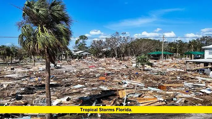
Tropical storms Florida residents are watching this week could bring heavy rain, gusty winds, and the potential for flash flooding across much of the state. As of July 14, 2025, meteorologists and the National Hurricane Center are closely monitoring a developing system that may impact the region over the next several days.
Table of Contents
Monitoring the Current Tropical Threat
A trough of low pressure is expected to form near the southeastern U.S. coast and drift westward, crossing the Florida peninsula before entering the Gulf of Mexico. While the chance of this disturbance developing into a named tropical storm remains low—around 20%—the system is forecast to bring significant rainfall to Central and South Florida through midweek.
- Rainfall Forecast: Up to two inches of rain is possible in parts of Central Florida between Monday and Tuesday, with locally higher amounts in some areas.
- Storm Impacts: Forecasters warn of the potential for localized flash flooding, frequent lightning, and strong wind gusts, especially during afternoon and evening thunderstorms.
- Development Chances: If the system strengthens, it would be named Tropical Storm Dexter. However, most models suggest slow development as it moves into the Gulf.
Key Points Summary
- A low-pressure system is bringing increased rainfall to Florida this week.
- There is a 20% chance of tropical development as the system moves west.
- Heavy rain, flash flooding, and strong storms are the main threats.
- The next named storm would be Dexter if development occurs.
- The 2025 hurricane season is forecast to be more active than average.
Tropical Storms Florida: Rainfall, Flooding, and Preparedness
The pattern of tropical storms Florida is experiencing this July follows the recent impact of Tropical Storm Chantal, which made landfall along the Carolina coast earlier in the month. Chantal brought flooding rains to Florida before moving north, underscoring the need for ongoing vigilance during hurricane season.
Recent Storms and Seasonal Outlook
- Tropical Storm Chantal: Formed on July 4, brought excessive rainfall to Florida and the Southeast, and caused damaging floods as it moved up the coast.
- Previous Systems: Andrea and Barry were short-lived but contributed to the season’s rainfall totals.
- Season Forecast: NOAA predicts 13 to 19 named storms for the Atlantic hurricane season, with 6 to 10 becoming hurricanes and 3 to 5 reaching major hurricane status.
| Storm Name | Formation Date | Main Impact Area | Status |
|---|---|---|---|
| Andrea | June 2025 | Gulf of Mexico | Dissipated |
| Barry | Late June | Texas, Gulf Coast | Dissipated |
| Chantal | July 4, 2025 | Florida, Carolinas | Dissipated |
What Residents Should Do
- Stay Informed: Monitor updates from the National Hurricane Center and local meteorologists.
- Prepare for Flooding: Have a plan for possible flash floods, especially in low-lying or flood-prone areas.
- Check Emergency Supplies: Ensure you have food, water, and medical supplies for at least three days.
- Secure Outdoor Items: Bring in or tie down loose objects that could become projectiles in strong winds.
What’s Next for Tropical Storms Florida?
Looking ahead, the tropical disturbance currently affecting Florida is expected to move into the Gulf of Mexico by midweek. While the chance of it becoming a named storm remains low, the primary concern is heavy rainfall and the potential for flooding across the peninsula.
Meteorologists caution that even weak tropical systems can bring significant hazards, especially when they move slowly and dump large amounts of rain over already saturated ground. The broader outlook for the 2025 hurricane season remains active, so Floridians should remain prepared as additional waves roll off the Atlantic in the coming weeks.
If you’ve experienced flooding or storm impacts in your area, or if you have tips for staying safe during tropical weather, share your thoughts in the comments below. Stay tuned for more updates as the situation develops.

