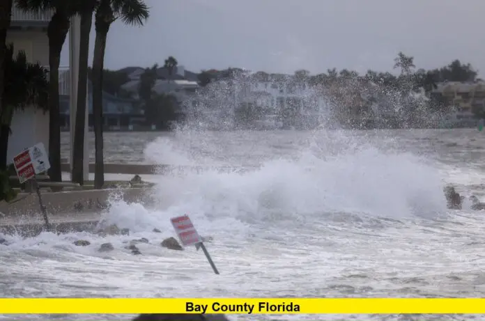
An ex-tropical disturbance tracking across the Gulf of Mexico is now triggering weather alerts in Bay County Florida, where residents are preparing for heavy rainfall, flash flooding, and storm-related disruptions over the next several days.
Table of Contents
Storm Threat Grows in Bay County Florida
The system, once monitored for tropical development, has weakened slightly in terms of wind speed but remains a powerful rainmaker. Meteorologists are watching as it moves across the central Gulf and edges closer to the Florida Panhandle, including Bay County Florida. Despite no longer being a fully tropical system, the risk of localized flooding is growing with each passing hour.
Rain bands have already begun sweeping into the area, and forecasters predict the heaviest downpours will occur between Thursday night and Saturday morning. The system’s slow movement could prolong rainfall and increase the chances of waterlogging in flood-prone neighborhoods.
Key Points Summary
- A disorganized tropical disturbance is moving toward Bay County Florida, bringing a major rain threat.
- Flash flooding is possible from Thursday to Saturday.
- Rain totals may range between 4 to 8 inches, with some isolated areas seeing up to 10 inches.
- Local emergency crews are on standby, and residents are urged to prepare.
Flooding Concerns for Bay County Residents
Local emergency management has issued a flood watch for much of the region, especially areas near creeks, rivers, and poorly drained urban zones. The ex-tropical system is expected to cause:
- Street flooding in low-lying parts of Panama City and surrounding neighborhoods.
- Stormwater backups due to heavy, persistent rainfall overwhelming drainage systems.
- Disruption to daily commutes, with several routes likely to become waterlogged or impassable.
Residents are advised to remain indoors during peak rainfall and avoid driving through flooded roads. Bay County schools and public services are closely monitoring the system, with potential for closures or schedule adjustments depending on evolving conditions.
What to Expect Through the Weekend
Weather models show a high concentration of rainfall developing over the northern Gulf Coast, with Bay County Florida on the eastern edge of the disturbance’s core. This will lead to:
- Prolonged bands of rainfall
- Thunderstorms embedded within those bands
- Gusty winds up to 30 mph
- Minor coastal flooding in areas close to the bay and estuaries
Wind damage is not the central concern, but saturated soils and high tide could cause flooding in basements, garages, and ground-floor businesses.
Tips to Stay Safe During the Flood Threat
With conditions expected to deteriorate quickly, here are practical steps Bay County residents should take:
| Action | Benefit |
|---|---|
| Check local alerts | Stay informed on new flood warnings |
| Elevate valuables | Protect electronics, documents, and furniture |
| Avoid underpasses | They flood quickly and pose danger |
| Use sandbags if needed | Shield doorways and garage openings |
| Prepare for power outages | Charge phones, and stock flashlights and batteries |
Residents living near the coastline or in flood-prone areas should also keep an overnight bag ready in case evacuation becomes necessary.
Will the System Intensify Again?
Although the system is no longer a named storm and isn’t expected to become one, it still carries enough tropical moisture to be a serious threat. As it moves westward, forecasters believe it will continue to impact areas across the Gulf Coast. For Bay County Florida, the next 48 hours are the most critical.
The lack of strong upper-level winds means the system is slow-moving, which increases rainfall totals over time. While it may not become a full-blown depression again, its ability to dump relentless rain makes it hazardous nonetheless.
Community Response in Bay County Florida
Local authorities have activated their emergency plans. Police and fire departments are preparing for water rescues and road closures. Community centers are being reviewed as possible emergency shelters if conditions worsen.
Residents are encouraged to:
- Avoid unnecessary travel after dark
- Clear storm drains around their homes
- Check on elderly or disabled neighbors
- Bring pets inside and secure outdoor belongings
County officials stress the importance of staying alert, not panicking, and following official instructions as the situation develops.
Final Thoughts
While this system may not have a name, its impact is real. Bay County Florida faces days of soaking rain, risky flood conditions, and potential disruptions. Stay weather-aware, help your neighbors, and take proactive steps now to protect your home and family. Have tips to share or a question about safety measures? Drop a comment below and join the conversation.

