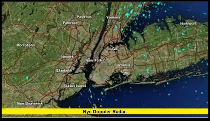
New York’s weather monitoring network plays a critical role each day, especially during periods of rain, coastal storms, and winter weather. The nyc doppler radar system, built around federal long-range radars and airport-based terminals, is fully operational today and delivering updated data for forecasters, emergency managers, and the public. Current radar imagery across the region shows active monitoring of precipitation trends, storm motion, and low-level wind patterns, giving New Yorkers clear insight into developing weather.
Table of Contents
How the radar network covering New York City operates
The regional backbone: KOKX NEXRAD
The primary radar serving New York City is the NEXRAD WSR-88D located in Upton, New York. This long-range radar scans the atmosphere in multiple elevation slices and produces both reflectivity and Doppler velocity. Reflectivity shows rain, snow, or mixed precipitation intensity, while Doppler products reveal wind direction and speed within storms.
This radar provides continuous coverage across Long Island, the five boroughs, the Hudson Valley, northeastern New Jersey, and parts of coastal Connecticut. It is the main tool used for issuing severe weather alerts, flash flood warnings, and winter storm updates.
Airport radars: JFK, Newark, and LaGuardia
Terminal Doppler Weather Radars (TDWR) at JFK, Newark, and LaGuardia focus on detecting hazardous low-level wind patterns such as microbursts, wind shear, and rapidly shifting gust fronts.
While these systems operate at shorter range than the regional NEXRAD, they deliver finer resolution near the surface—data especially important for aviation safety and rapidly evolving thunderstorms. Together, the NEXRAD and TDWR network provides layered coverage that minimizes blind spots.
Recent radar maintenance and status updates
Routine seasonal maintenance
Today, all radars covering the New York metropolitan area are operational. Recent months included scheduled seasonal maintenance on several airport radars, including quick service windows for JFK’s terminal radar. These brief pauses are typical and designed to ensure accuracy during periods of active weather.
NEXRAD long-term upgrades
The Upton radar, like all U.S. NEXRADs, is part of an ongoing Service Life Extension Program. This multi-year project involves:
- Pedestal and drive system refurbishments to keep the radar’s mechanical rotation stable
- Signal processor updates that improve data clarity
- Radome inspections and repairs that protect internal components from coastal storms and salt exposure
- Backup power system modernization to prevent gaps during outages
All upgrade work is scheduled in advance, and any downtime is publicly posted, allowing forecasters to prepare alternate coverage plans using neighboring radars in New Jersey, Connecticut, or Pennsylvania.
What radar is showing for today’s weather
Overview of current conditions
Radar imagery this morning indicates a band of precipitation moving through the region, associated with a coastal disturbance sliding northeast of the city. Light to moderate rain has been the dominant type across New York City and Long Island. Farther inland—particularly the lower Hudson Valley and higher elevations—mixed precipitation and wet snow have been reported.
Winter weather considerations
Interior counties north and west of New York City remain under winter weather advisories due to the potential for accumulating wet snow and slushy road conditions. Radar scans show a sharp gradient in precipitation type, with the rain–snow line shifting throughout the morning.
For New York City itself, temperatures have hovered near the upper 30s to low 40s, keeping conditions mainly rainy.
How forecasters use radar to protect the public
Tracking storm structure
Meteorologists monitor radar constantly to analyze:
- The height of precipitation cores
- Areas of rotation within thunderstorms
- The position of rain–snow boundaries
- Bands of heavier snow that may reduce visibility
- Low-level wind shear affecting major airports
Doppler velocity data is crucial during severe weather because it reveals wind changes that cannot be detected by surface sensors alone.
Verifying warnings and advisories
When a winter storm or coastal low approaches, radar helps confirm whether snowfall rates match forecast models. This ensures advisories remain accurate and updated in real time.
Flood monitoring
During heavy rain, radar estimates rainfall totals by integrating reflectivity over time. These precipitation estimates help determine when to issue flash flood warnings in areas with poor drainage or tidal vulnerability.
Practical radar guidance for New Yorkers
How to interpret radar images
Radar maps available to the public show color-coded reflectivity:
- Green/yellow: light to moderate rain
- Orange/red: heavy rain or strong storms
- Blue/light pink: snow or mixed precipitation
- Bright pink/purple: heavy mixed precipitation or ice potential
Higher-resolution views reveal storm movement and intensity trends that help commuters plan travel.
Why radar timing matters
Each radar scan includes a timestamp. Updated imagery every few minutes helps track how quickly a band of precipitation is moving. During winter events, very small shifts in temperature and wind direction can change rain to snow or snow to sleet—making precise timing essential.
What to monitor during airport travel
Airport passengers should be aware that:
- Strong wind shear or microburst signatures can cause runway delays
- Low visibility from snow or heavy rain may slow departures
- Coastal winds influence air traffic spacing and approach paths
Airport radars feed into these decisions and help maintain safety.
Today’s bottom-line assessment
All primary and terminal radars that serve the New York City region are functioning today. Data from the NEXRAD radar in Upton and the airport TDWR network confirms ongoing precipitation associated with a coastal low. Rain dominates across the city and Long Island, with wintry precipitation confined inland.
The radar network continues to offer reliable, real-time awareness for residents, commuters, and aviation operations. Continued maintenance and long-term upgrades help ensure the system remains accurate and dependable during busy winter months.

