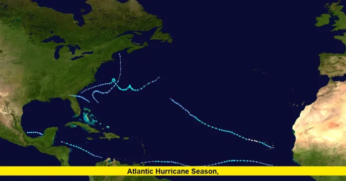
The 2025 Atlantic hurricane season is showing signs of intensifying as the first hurricane is expected to form soon. After several tropical storms earlier in the season, meteorologists predict a tropical rainstorm developing into Hurricane Erin this week over the Atlantic Ocean. This marks a crucial moment as the season continues to unfold with above-average activity anticipated for the months ahead.
Meteorologists are closely monitoring a cluster of showers and thunderstorms that formed near the Cabo Verde Islands. Due to favorable conditions—including warm Atlantic waters, low wind shear, and minimal dust—the storm is expected to strengthen and become the first hurricane of the season. This timing aligns closely with the average date for the first hurricane, August 11, although this year’s start has been slightly delayed with tropical activity beginning late June.
Significantly, the National Oceanic and Atmospheric Administration (NOAA) forecasts the 2025 Atlantic hurricane season to be above normal, with 13 to 18 named storms and 5 to 9 hurricanes expected through November 30. Among these, 2 to 5 could escalate into major hurricanes with Category 3 or higher intensity. These projections reflect the current warmer-than-average ocean surface temperatures and a strong West African monsoon that fuels tropical storm development.
Read Also-Tropical Storms Atlantic: 2025 Season Shows Signs of Increasing Activity
What this means for Florida is a heightened chance of experiencing weather impacts during the peak hurricane months. Although the first hurricane is predicted to stay east of the U.S. East Coast, Florida remains in the crosshairs for potential storms later this season because of the Atlantic’s warm waters. Residents should be prepared for the possibility of local heavy rain, gusty winds, and increased ocean surf affecting Florida’s coastlines.
Here is a quick summary of what the 2025 Atlantic hurricane season looks like so far:
- Four tropical storms formed before August, including Andrea and Barry.
- The first hurricane of the season, Erin, is likely to develop this week near the Cabo Verde Islands.
- NOAA predicts 13-18 named storms, with 5-9 reaching hurricane strength.
- 2-5 major hurricanes are forecasted, posing a risk to coastal regions.
- Warm sea surface temperatures and a strong West African monsoon support increased activity.
- Florida’s weather could see indirect impacts initially, with potential direct threats as the season peaks.
As the season progresses, forecasts will continue to refine the path and strength of storms. Floridians should keep informed and ready, as even storms that do not make landfall can drive rough surf and rip currents. Emergency kits, clear evacuation plans, and awareness of official updates will be essential for safety.
The first hurricane’s development marks a key phase in the 2025 Atlantic hurricane season, reminding us all of the ongoing need to stay alert. Keep an eye on trusted weather sources for updates, and feel free to share your thoughts or local weather experiences in the comments below to stay connected and prepared.

