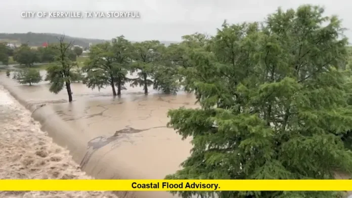
A coastal flood advisory has been issued for parts of North Carolina and Southeast Louisiana today, warning residents and travelers about the risk of minor tidal flooding as storms sweep across the Southeast and Mid-Atlantic regions.
The advisory affects low-lying coastal areas, especially around New Hanover County, North Carolina, and parishes like Jefferson and Lafourche in Louisiana. High tides, combined with persistent onshore winds and scattered storms, are pushing water inland, leading to minor roadway flooding and water covering coastal paths and parking areas.
Table of Contents
Coastal Flood Advisory: Areas at Risk Today
Coastal flood advisories are typically issued when tides or storm surges cause water levels to rise just enough to flood vulnerable areas like beach access roads, marinas, or seaside neighborhoods. Today, this condition is expected to last into the evening in both North Carolina and Louisiana.
Residents in affected areas should:
- Avoid driving through saltwater-flooded streets
- Move vehicles from flood-prone coastal parking zones
- Be cautious near marinas, boardwalks, and sea walls
Storm activity today is enhancing the water rise, particularly in regions already saturated from recent rainfall.
Key Points Summary
| Key Element | Details |
|---|---|
| Affected Regions | New Hanover County (NC), Jefferson, Lafourche, and surrounding (LA) |
| Flood Type | Minor coastal flooding from tides and onshore flow |
| Expected Duration | Through this evening and into early Monday morning |
| Main Impacts | Roadway flooding, limited access to beach paths, marina disruptions |
| Associated Weather | Scattered storms, increased rain rates, moderate winds |
Damaging Winds and Heavy Rain Threat Looms Over the Triad
Elsewhere, the Triad region (North Carolina) faces a separate concern: a strong risk of damaging winds and flash flooding through tonight. Isolated thunderstorms are expected to intensify early this week, with the potential to produce wind gusts exceeding 50 mph, intense lightning, and downpours that may cause temporary street flooding in urban zones.
Key facts for Triad residents:
- Storms most likely during the late afternoon and early evening
- Flash flood-prone zones may see quick water accumulation
- Trees and power lines could be vulnerable to gusty winds
As this weather pattern unfolds, authorities are monitoring additional river flooding and warning residents to avoid low-lying areas during peak storm hours.
Understanding the Coastal Flood Advisory
The coastal flood advisory is not a hurricane or storm surge warning—it signifies minor flooding, often caused by high tides coinciding with weather disturbances. Impacts are typically limited to:
- Street flooding in coastal zones
- Water washing over dunes or seawalls
- Beach erosion or closure of waterfront trails
These conditions are often temporary but can be hazardous if not taken seriously. Coastal residents and tourists should remain alert during high tide periods, especially when accompanied by rain or strong winds.
Flash Flood Watch for South Florida and Mid-Atlantic Zones
In South Florida, a flash flood watch remains in effect due to the potential for up to 7 inches of rainfall in certain areas. Urban neighborhoods could face storm drain backups and ponding on roads. Meanwhile, parts of New Jersey, Philadelphia, and Delaware are also under flood watches today, with some storms capable of dumping up to 3 inches of rain in a short period.
Across these regions, common risks include:
- Flash flooding of underpasses and low roads
- Temporary road closures
- Airport delays due to lightning and visibility
Final Thoughts
While today’s coastal flood advisory doesn’t indicate catastrophic flooding, it serves as a critical reminder of the power of tidal waters—especially when combined with stormy conditions. Whether you’re living along the Carolina coast, vacationing in Louisiana, or navigating the rain-soaked streets of the Triad, staying alert and cautious is the best protection.
Have you seen coastal flooding in your area today? Let us know in the comments below and check back here for further weather developments.

