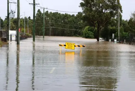
A flash flood warning remains in effect for parts of the Mid-Atlantic and Northeast U.S., with the most immediate threat focused on South Jersey and surrounding regions as of early Saturday, May 31, 2025. The National Weather Service (NWS) issued a flash flood warning for Gloucester and Salem counties in New Jersey, effective until 3:15 a.m. Saturday. This alert was triggered by intense thunderstorms late Friday night, with Doppler radar detecting significant rainfall and additional downpours expected to push totals even higher.
At 11:12 p.m. Friday, the NWS warned that rainfall rates could reach 1 to 2 inches per hour, with a total of 1 to 2 more inches possible overnight. The warning area includes Chester, PA, Pennsville, NJ, and Brookhaven, where flash flooding is either already occurring or imminent. Residents are urged to avoid driving through flooded roads, especially at night, as most flood-related deaths happen in vehicles. Meteorologists caution that flooding could impact small streams, urban areas, highways, and other low-lying spots.
This flash flood warning comes after a week of severe weather across the region. On May 30, more than 21 million people across the Mid-Atlantic, including parts of Pennsylvania, Maryland, and Virginia, were under flood watches as deadly storms shifted east from Texas and Kentucky. The NWS has highlighted that the threat of flash flooding continues into the weekend, with additional rounds of heavy rain possible.
Elsewhere, the risk of flash flooding is not limited to New Jersey. Parts of southeastern Pennsylvania, including Chester County, have also been under warnings as storms move through. Earlier this month, widespread rain and storms led to flooding in Somerset County, PA, with evacuations, water rescues, and road closures reported. While water levels have since receded in those areas, the saturated ground remains vulnerable to new rainfall.
Looking ahead, forecasters expect the severe weather threat to gradually diminish through Saturday, but isolated showers and thunderstorms could still bring locally heavy rain. Residents in all affected areas should remain alert for further warnings and be prepared to act quickly if conditions deteriorate.
Stay tuned to the latest updates from the National Weather Service and local authorities, and remember: never drive through flooded roadways. Your safety depends on staying informed and making smart decisions during flash flood warnings.

