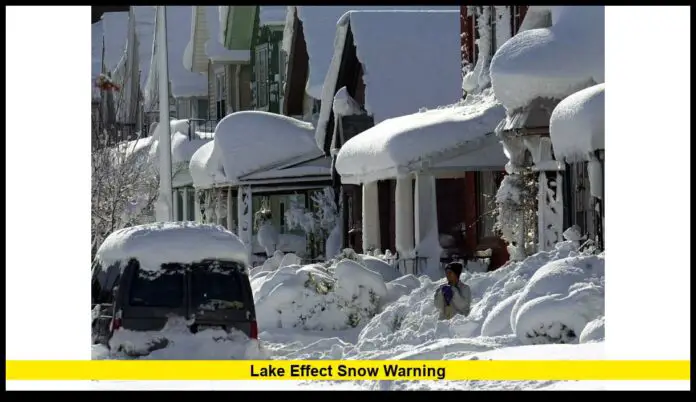
A lake effect snow warning is currently affecting parts of the Great Lakes region, as intense, narrow bands of snow driven by cold Arctic air over warm lake waters continue to dump significant snowfall. Meteorologists report hazardous travel, white-out conditions and infrastructure impacts in several counties around Lakes Michigan, Erie and Ontario.
Table of Contents
Latest Updates & Affected Areas
- The warning covers zones downwind of Lake Michigan, Lake Erie and Lake Ontario.
- For example, near the Chicago / northwest Indiana area, one band reported snowfall accumulations approaching 10 to 12 inches in under 24 hours.
- In western New York and northwestern Pennsylvania (including the southern shore of Lake Erie), snowfall of 8 to 12 inches is expected, with localized higher totals.
- Strong lake-to-land temperature differences are fueling the event: cold air flowing over relatively warm, unfrozen lake water is increasing moisture uptake and intensifying the snow bands.
- Wind gusts near the lakes are reaching 30-40 mph, producing blowing and drifting snow, with periods of near zero visibility.
What Is a Lake-Effect Snow Warning?
A lake effect snow warning is issued when heavy snowfall generated by lake-effect processes is imminent or underway. These snow bands form when very cold air moves over the comparatively warmer lake water, picks up moisture and deposits it on the downwind shorelines. The snowfall tends to be very localized but intense, making conditions hazardous for travel and infrastructure.
Why This Event Matters
- This is one of the earliest major lake-effect snow outbreaks of the season in the region.
- The heaviest bands are producing snowfall rates of several inches per hour across narrow corridors.
- Travel disruptions are already being reported: interstates near lake shorelines are becoming clogged, airports and school operations have issued delays or closures.
- The combination of cold Arctic air, strong lake moisture return and gusty winds is creating a more volatile event than a typical winter snow band.
Impacts & Guidance
Travel and Infrastructure
- Roadways in the primary downwind zones are experiencing rapid snow accumulation, blowing and drifting snow, and drastically reduced visibility.
- The warning includes strong recommendations: avoid travel unless essential in affected counties.
- If travel cannot be avoided: carry emergency supplies (water, blankets, flashlight), and check road & weather updates frequently.
- Homeowners and municipalities: expect potential stress on tree limbs and power lines from heavy snow + wind; power outages are possible.
Snowfall & Timing
| Region | Expected Accumulation | Timing |
|---|---|---|
| NW Indiana / near Chicago | Up to ~10-12 inches in spots | Sunday night through Monday |
| Southern Erie & NW Pennsylvania | 8-12 inches with locally more | Monday night into Tuesday |
| Michigan / Upstate New York | 8-12 inches likely, locally higher | Monday afternoon into Tuesday |
Safety Precautions
- Avoid travel while warning is in effect in your area.
- If you must travel: slow down, allow extra distance, watch for drifting snow and changing visibility.
- Be aware that snow bands can set up quickly, drop large amounts, then shift or move elsewhere—conditions may change suddenly.
- At home: clear snow from vents, keep drives and sidewalks clear, and be cautious of roof loads or heavy accumulations on structures.
What’s Next?
Meteorologists indicate that the intense lake-effect snow bands should begin to diminish by later Tuesday as the Arctic air mass gradually weakens and the lakes begin to stabilize. However, the broader pattern of cold air across the eastern U.S. remains in place, so additional lake-effect snow episodes cannot be ruled out—especially downwind of the Great Lakes where moisture return and cold flow align again.
Stay safe, keep your local updates close, and share your snowfall reports if you’re in an affected zone—feel free to comment with your local conditions or questions.

