The National Hurricane Center continues monitoring a tropical disturbance in the Atlantic that forecasters expect will likely become Tropical Depression Seven within the next few days. The disturbance emerged off the coast of Africa last weekend and is currently being tracked for further development.
Current Development Status
The Atlantic system has been given a 30% chance to develop in the next two days and 70% chance to develop in the next seven days. The disturbance is positioned in the eastern tropical Atlantic, where environmental conditions remain favorable for gradual strengthening.
Meteorologists report that the system continues to produce disorganized showers and thunderstorms as it moves across the Atlantic basin. The timing proves significant as September typically marks one of the most active periods of hurricane season.
Pacific Basin Activity Continues
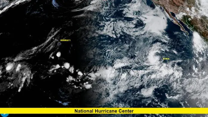
While monitoring Atlantic development, the National Hurricane Center also tracks significant Pacific activity. Hurricane Kiko currently maintains maximum sustained winds near 100 mph and is centered about 1,775 miles east of Hilo, moving west at 6 mph.
Forecasters expect Kiko to undergo “additional steady strengthening during the next day or so, and Kiko is likely to become a major hurricane by Wednesday.” The storm remains a compact system with hurricane-force winds extending up to 15 miles from its center.
Above-Normal Season Forecast Continues
NOAA’s outlook for the 2025 Atlantic hurricane season predicts a 60% chance of an above-normal season, with forecasters expecting a range of 13 to 19 total named storms. The season runs from June 1 to November 30, with peak activity typically occurring through September and October.
“Many of the factors we identified ahead of the season are still at play, and conditions are largely tracking along with our May predictions,” said Matt Rosencrans, lead hurricane season forecaster with NOAA’s National Centers for Environmental Prediction.
Monitoring Multiple Systems
The National Hurricane Center’s comprehensive tracking extends across both Atlantic and Pacific basins during this active period. Forecasters maintain constant surveillance of atmospheric conditions that could lead to tropical development.
Advanced satellite technology and computer modeling systems enable meteorologists to provide increasingly accurate forecasts and development probabilities. These improvements help coastal communities prepare for potential impacts well in advance of storm formation.
Preparedness Remains Essential
As tropical activity continues across multiple ocean basins, residents in hurricane-prone areas should maintain their preparedness strategies. Having emergency supplies, evacuation plans, and communication protocols ready before storms develop provides the best protection for families and property.
The National Hurricane Center emphasizes that early preparation saves lives and reduces property damage when tropical systems threaten populated areas. Officials recommend reviewing insurance coverage, securing important documents, and identifying safe evacuation routes.
Looking Ahead
Weather patterns suggest continued tropical development potential across the Atlantic basin as we progress through September. Forecasters will continue providing regular updates on all systems of interest, including the potential formation of Tropical Depression Seven.
The center’s 24/7 monitoring capabilities ensure that any significant changes in storm development or track will be communicated immediately to emergency management officials and the public.
Stay informed about the latest developments as the National Hurricane Center continues tracking this Atlantic disturbance and monitoring conditions for additional tropical formation.

