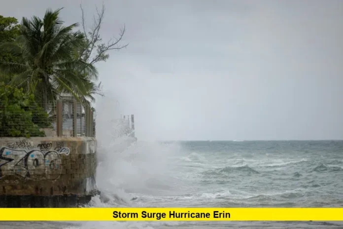
Hurricane Erin has rapidly intensified to a dangerous Category 5 storm with 160 mph winds, becoming one of the most explosive hurricane developments in Atlantic history. The powerful system poses significant storm surge threats to coastal areas as it continues its northward trajectory through the Caribbean toward the U.S. East Coast.
Hurricane Erin became the first hurricane of the 2025 Atlantic season on Friday, with sustained winds initially at 75 mph as it moved toward the Leeward Islands. The system underwent remarkable rapid intensification over the weekend, shocking meteorologists with its unprecedented strength gain.
Table of Contents
Current Status and Intensity
Hurricane Erin exploded in strength to a Category 5 storm in the Caribbean before weakening on Saturday, though it remains an extremely dangerous Category 4 system. Despite fluctuations in intensity, the storm is remaining formidable this weekend, with Hurricane Hunters reporting an active eyewall replacement cycle.
The National Hurricane Center continues monitoring Erin’s structure as it maintains major hurricane status. Wind speeds have fluctuated between Category 4 and 5 intensity, demonstrating the volatile nature of this rapidly developing system.
Storm Surge Concerns for Coastal Areas
While Hurricane Erin is not expected to make direct landfall on the U.S. mainland, the hurricane is expected to take a path between the United States East Coast and Bermuda next week bringing powerful seas and dangerous surf. This track raises serious concerns about storm surge impacts along the Eastern Seaboard.
North Carolina beaches may see dangerous rip currents and erosion next week, with coastal flooding possible from the storm’s powerful wave action. The storm surge hurricane Erin generates could affect areas hundreds of miles from the storm’s center.
Geographic Impact Areas
Hurricane Erin is moving past the Greater Antilles, bringing impacts from the Caribbean to the East Coast and Bermuda. Current projections show the system affecting multiple regions:
Caribbean Impact Zone:
- Northern Leeward Islands experiencing heavy rainfall
- Puerto Rico facing continued precipitation threats
- Greater Antilles region under hurricane watches
U.S. East Coast Preparations:
- Strong waves and rip currents possible along the East Coast of the United States as early as next week
- Coastal erosion concerns from the Carolinas to New England
- Beach hazards extending several hundred miles from storm center
Rapid Intensification Phenomenon
Powerful Hurricane Erin has undergone a period of astonishingly rapid intensification — a phenomenon that has become far more common in recent years as the planet warms. The storm’s explosive development caught many forecasters off guard with its speed and intensity.
Meteorologists note that rapid intensification events have become increasingly common in recent Atlantic hurricane seasons. Erin’s development from tropical storm to major hurricane status occurred within an exceptionally short timeframe.
Forecast Track and Timeline
Erin will be a long-track storm and will eye the United States next week, though current projections suggest it will remain offshore. The system’s path between the U.S. coast and Bermuda positions it to generate significant wave energy and coastal impacts.
Weather models continue tracking Erin’s movement as it progresses northward through the Atlantic. The storm’s future intensity and exact track remain crucial factors in determining coastal impact severity.
Safety Preparations
Coastal residents from the Carolinas to New England should monitor conditions closely as Erin approaches next week. Even without direct landfall, the storm’s size and intensity mean dangerous surf conditions and potential coastal flooding.
Emergency management officials recommend staying informed about changing conditions and avoiding beach activities when hazardous surf develops. Rip current risks will be elevated along affected coastlines.
The 2025 Atlantic hurricane season has started with remarkable intensity, and residents in hurricane-prone areas should remain vigilant as the season progresses. Stay tuned to official weather sources and share your thoughts on how coastal communities can better prepare for these increasingly powerful storms.

