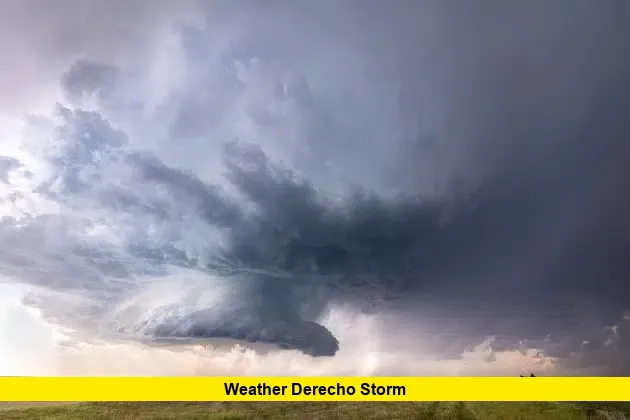
A major weather derecho storm is sweeping across Minnesota this evening, bringing destructive winds, intense lightning, and hail to cities like St. Cloud and beyond. With the line of storms rapidly approaching from the west, emergency warnings have been issued, urging residents to seek shelter as the threat intensifies across central and southern Minnesota.
By early evening, the fast-moving storm system had already begun pounding areas west of St. Cloud with wind gusts estimated between 70 and 90 miles per hour. Radar signatures confirmed a bowing squall line—a key sign of a developing derecho. As this system moves eastward, cities in its path are bracing for widespread power outages, uprooted trees, and flying debris.
Table of Contents
Severe Weather Timeline Across Minnesota
Meteorologists began warning about this outbreak earlier today, identifying atmospheric instability, high dew points, and intense wind shear—classic ingredients for a derecho. By 7:00 p.m., the first wave of severe thunderstorms formed near the South Dakota border and accelerated into western Minnesota.
- 7:30 PM: Severe storms hit Alexandria and Melrose with damaging winds and nickel-sized hail.
- 8:15 PM: The St. Cloud area experienced gusts near 80 mph, triggering sirens and spotter reports of downed power lines.
- 9:00 PM – 10:00 PM: Twin Cities metro area expected to feel the brunt of the storm, including possible embedded tornadoes and power flash sightings.
What Makes a Derecho So Dangerous?
A derecho is not your average thunderstorm. It’s a massive, long-lived windstorm associated with a line of intense thunderstorms. For a storm system to be classified as a derecho, it must produce wind damage along a path of at least 240 miles, with gusts over 58 mph—and frequently, much higher.
What sets tonight apart is the potential for hurricane-force winds in multiple counties. Straight-line winds from this system could exceed 90 mph in some pockets, especially where the bow echo intensifies along the storm’s leading edge.
Areas at Greatest Risk
Below is a quick reference for the counties and cities at the highest risk tonight:
| Region | Wind Gust Potential | Special Alerts Active |
|---|---|---|
| St. Cloud & Benton Co. | 70–90 mph | Severe Thunderstorm Warning |
| Twin Cities Metro | 65–80 mph | Wind & Hail Watches Issued |
| Southern MN Counties | 60–75 mph | Flood Watches Possible |
Emergency responders have been put on high alert. Power companies are staging repair crews, anticipating mass outages in the storm’s wake.
Safety Measures to Take Immediately
With the weather derecho storm continuing its path across Minnesota, the following safety actions are strongly recommended:
- Move to a basement or interior room: Avoid windows and exterior doors.
- Secure loose outdoor items: Furniture and trash bins can become dangerous projectiles.
- Charge devices and prepare for outages: Have flashlights and batteries ready.
- Stay informed: Monitor alerts through weather apps and emergency alerts.
Many residents in St. Cloud have already reported brief blackouts and tree damage as the derecho moved through. Social media posts show snapped tree limbs blocking roads and roofing shingles blown off several homes.
What Happens Next?
The storm is expected to push into Wisconsin by early Tuesday morning. Cleanup efforts will likely begin at sunrise, but authorities are asking people to stay indoors and avoid downed power lines and damaged structures tonight.
Storm spotters and meteorologists will evaluate if the event meets the criteria for a confirmed derecho after reviewing wind damage reports, radar data, and storm tracks. However, the current scale and strength already indicate this is one of the most significant weather events Minnesota has faced this summer.
This derecho is a dangerous reminder of how quickly summer storms can escalate. If you’ve been affected by tonight’s weather or have updates from your local area, drop a comment below and share your experience to help others stay alert and aware.

